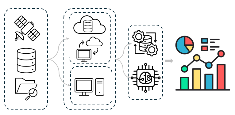
Workflow
My research leverages a robust skillset encompassing advanced computational and analytical techniques. I am proficient in handling and analyzing large, complex datasets, utilizing cloud computing resources for efficient processing and storage. My coding expertise spans multiple languages, including R, Python, JavaScript, and Matlab, enabling me to develop custom scripts and algorithms for data analysis, visualization, and model development. Furthermore, I possess significant experience in process-based and numerical modeling, particularly with SWAT/SWAT+, allowing me to simulate and analyze complex hydrological and biogeochemical processes. This combination of data science, programming, and modeling skills forms the foundation of my data-driven research approach.
Research Highlights
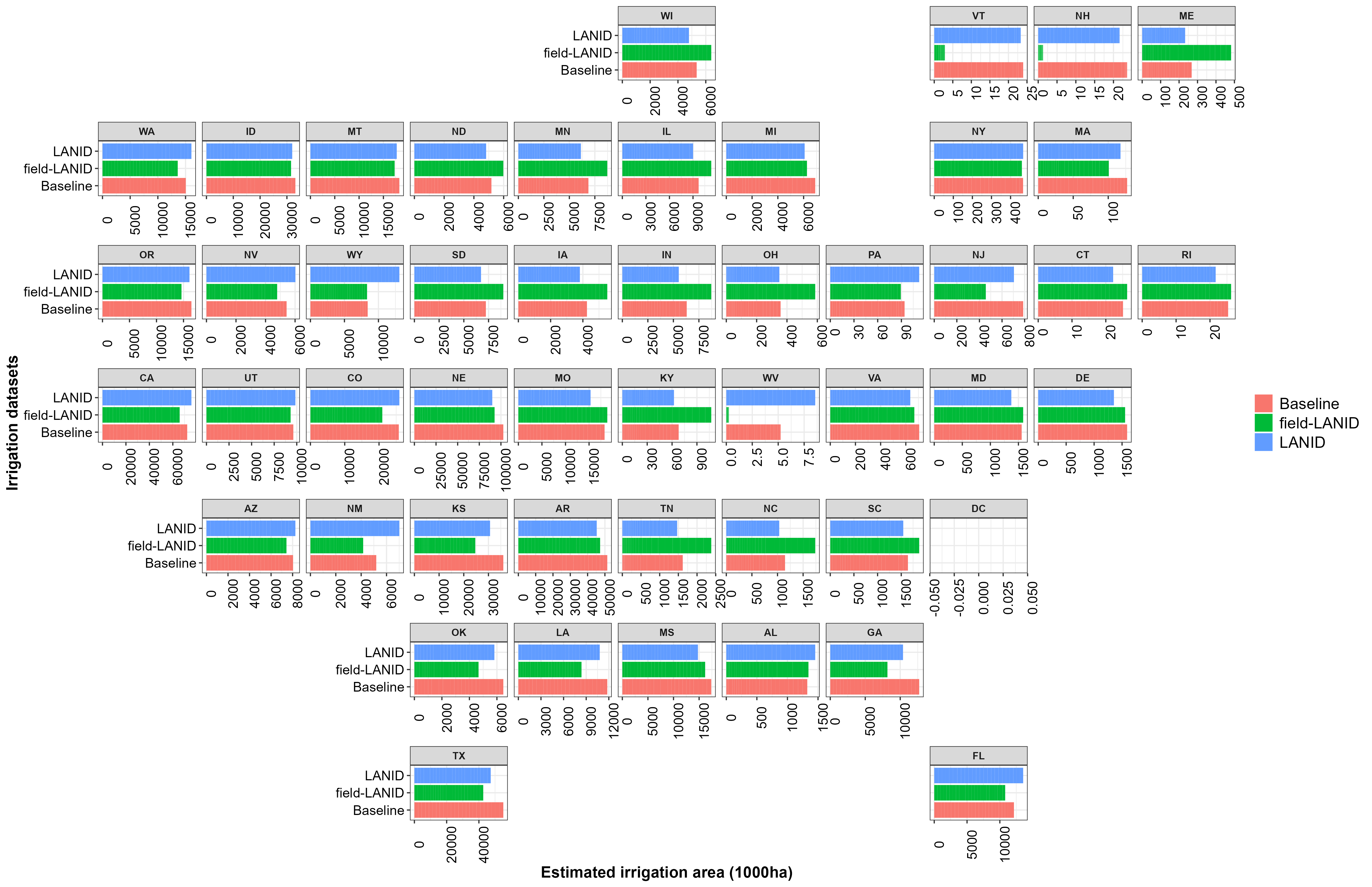
Field-scale Irrigation Mapping
Using publicly available satellite imagary I map field-level irrigation practices across the U.S. utilizing geospatial data techniques and field-scale machine learning classification. This work supports improved agricultural water management, land use planning, sustainability, and resiliency in the face of resource challenges.
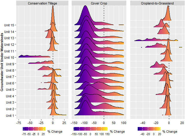
Water Quality Opportunities: Conservation Prioritization
In this project, I investigate the prioritization of fields for cover crops, conservation tillage, and grassland restoration to achieve the best water quality outcomes. Through a combination of soil and terrain analysis, machine learning, and hydrologic biogeochemical modeling, I aim to identify the most effective management practices for reducing nutrient pollution and enhancing watershed health.